
Puy Mary topographic map
Interactive map
Click on the map to display elevation.
About this map
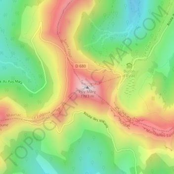
Name: Puy Mary topographic map, elevation, terrain.
Average elevation: 4,636 ft
Minimum elevation: 3,727 ft
Maximum elevation: 5,781 ft
Other topographic maps
Click on a map to view its topography, its elevation and its terrain.
Les Monts du Cantal
Frankreich > Auvergne-Rhone-Alpen > Mandailles-Saint-Julien
Les Monts du Cantal, Mandailles-Saint-Julien, Aurillac, Cantal, Auvergne-Rhone-Alpen, Metropolitanes Frankreich, 15590, Frankreich
Average elevation: 2,949 ft