
Samut Songkhram Province topographic map
Interactive map
Click on the map to display elevation.
About this map
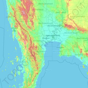
Name: Samut Songkhram Province topographic map, elevation, terrain.
Location: Samut Songkhram Province, Thailand (10.79769 97.40197 15.91769 102.52197)
Average elevation: 410 ft
Minimum elevation: -10 ft
Maximum elevation: 6,086 ft
Other topographic maps
Click on a map to view its topography, its elevation and its terrain.
Amphawa
Thailand > Samut Songkhram Province
Amphawa, Suan Luang, Bang Khonthi District, Samut Songkhram Province, 75110, Thailand
Average elevation: 16 ft