
Thamalguda topographic map
Interactive map
Click on the map to display elevation.
About this map
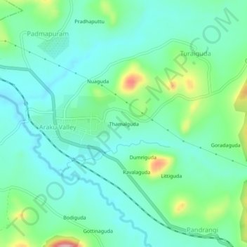
Name: Thamalguda topographic map, elevation, terrain.
Location: Thamalguda, Araku Valley, Andhra Pradesh, 531151, India (18.30339 82.87154 18.34339 82.91154)
Average elevation: 3,107 ft
Minimum elevation: 2,972 ft
Maximum elevation: 3,520 ft