Geolocate

Castroverde topographic map

Click on the map to display elevation.

About this map
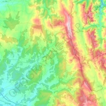
Name: Castroverde topographic map, elevation, terrain.

Location: Castroverde, Lugo, Galicia, Spain (42.93859 -7.43813 43.11439 -7.24337)

Average elevation: 2,077 ft

Minimum elevation: 1,332 ft

Maximum elevation: 3,366 ft

Gear up for your next adventure:

🚁Photography Drones - Capture stunning aerial views of landforms and topography
📡Handheld GPS Device - Reliable handheld GPS for outdoor navigation
🔌Solar Panel Charger - Charge gear sustainably outdoors
🔥Plasma Lighters - Windproof lighters that work in any weather condition
👓Polarized Sunglasses - Outdoor sunglasses for glare reduction

As an Amazon Associate, this site earns from qualifying purchases at no extra cost to you.