
Aquinnah topographic map
Interactive map
Click on the map to display elevation.
About this map
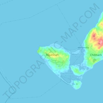
Name: Aquinnah topographic map, elevation, terrain.
Location: Aquinnah, Dukes County, Massachusetts, United States (41.29002 -70.92954 41.40379 -70.76520)
Average elevation: 10 ft
Minimum elevation: -36 ft
Maximum elevation: 279 ft