
Harar topographic map
Interactive map
Click on the map to display elevation.
Harar
Harar is the capital city of the Harari Region. The city also serves as the administrative center of the East Hararghe Zone in the Oromia Region. The ancient city is located on a hilltop in the eastern part of the country and is about five hundred kilometers from the Ethiopian capital Addis Ababa at an elevation of 1,885 metres (6,184 ft).
About this map
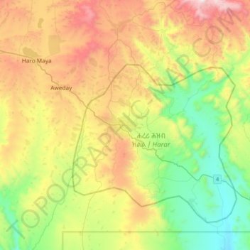
Name: Harar topographic map, elevation, terrain.
Location: Harar, Hareri, Harar, Ethiopia (9.15184 41.96844 9.47184 42.28844)
Average elevation: 6,027 ft
Minimum elevation: 4,144 ft
Maximum elevation: 8,986 ft