
Komani topographic map
Click on the map to display elevation.
About this map
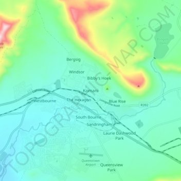
Name: Komani topographic map, elevation, terrain.
Average elevation: 3,766 ft
Minimum elevation: 3,383 ft
Maximum elevation: 5,276 ft
Other topographic maps
Click on a map to view its topography, its elevation and its terrain.
Komani
South Africa > Eastern Cape > Chris Hani District Municipality > Lukhanji Local Municipality > Komani
Average elevation: 3,491 ft