Geolocate

Venus topographic map

Click on the map to display elevation.

About this map
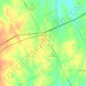
Name: Venus topographic map, elevation, terrain.

Location: Venus, Johnson County, Texas, 76084, United States (32.38686 -97.15672 32.46605 -97.06967)

Average elevation: 656 ft

Minimum elevation: 581 ft

Maximum elevation: 732 ft

Johnson County trails, hiking, mountain biking, running and outdoor activities

Other topographic maps

Click on a map to view its topography, its elevation and its terrain.

Highland

United States > Texas > Johnson County

Average elevation: 650 ft

Turkey Peak

United States > Texas > Johnson County > Burleson

Average elevation: 778 ft

Oak Hill

United States > Texas > Johnson County > Cleburne

Average elevation: 787 ft

Gear up for your next adventure:

🌐World Map Poster - Decorative world maps with topographic info
🪶LED Camping Lantern - Bright lantern for camp lighting
📷Action Cameras - Rugged cameras to document your journeys across rugged terrain
📡Handheld GPS Device - Reliable handheld GPS for outdoor navigation
📶Satellite Messenger - Communication device off‑grid

As an Amazon Associate, this site earns from qualifying purchases at no extra cost to you.