
Fleurimont topographic map
Interactive map
Click on the map to display elevation.
About this map
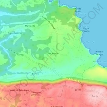
Name: Fleurimont topographic map, elevation, terrain.
Location: Fleurimont, Pointe-à-Pitre, Guadeloupe, France (15.94803 -61.26176 15.98803 -61.22176)
Average elevation: 233 ft
Minimum elevation: -3 ft
Maximum elevation: 636 ft