Geolocate

Northampton Center topographic map

Click on the map to display elevation.

About this map
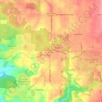
Name: Northampton Center topographic map, elevation, terrain.

Location: Northampton Center, Cuyahoga Falls, Summit County, Ohio, 44223, United States (41.14659 -81.55650 41.18659 -81.51650)

Average elevation: 968 ft

Minimum elevation: 758 ft

Maximum elevation: 1,073 ft

Summit County trails, hiking, mountain biking, running and outdoor activities

Gear up for your next adventure:

🥾Hiking Shoes - Durable and comfortable shoes for trail hiking
📖Nature Tracking Books - Learn to track wildlife and terrain
🪶Fire Starter Kit - Reliable fire starter for survival and camping
🩳Quick‑Dry Hiking Shorts - Comfortable and quick‑dry shorts for summer hiking
🚁Photography Drones - Capture stunning aerial views of landforms and topography

As an Amazon Associate, this site earns from qualifying purchases at no extra cost to you.