
Courant d'Huchet topographic map
Interactive map
Click on the map to display elevation.
About this map
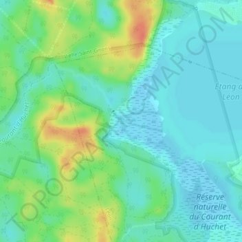
Name: Courant d'Huchet topographic map, elevation, terrain.
Average elevation: 52 ft
Minimum elevation: 7 ft
Maximum elevation: 154 ft
Other topographic maps
Click on a map to view its topography, its elevation and its terrain.
Étang de Léon
France > Nouvelle-Aquitaine > Léon
Étang de Léon, Rue des Berges du Lac, Léon, Dax, Landes, Nouvelle-Aquitaine, France métropolitaine, 40550, France
Average elevation: 33 ft