
Chupallar topographic map
Interactive map
Click on the map to display elevation.
About this map
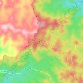
Name: Chupallar topographic map, elevation, terrain.
Average elevation: 902 ft
Minimum elevation: 390 ft
Maximum elevation: 1,322 ft
Other topographic maps
Click on a map to view its topography, its elevation and its terrain.
Coelemu
Chile > Región de Ñuble > Provincia de Itata > Coelemu
Coelemu, Provincia de Itata, Región de Ñuble, 3970000, Chile
Average elevation: 541 ft