
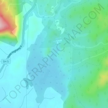
Lake Ngakoro topographic map
Interactive map
Click on the map to display elevation.
About this map
Name: Lake Ngakoro topographic map, elevation, terrain.
Average elevation: 1,145 ft
Minimum elevation: 1,007 ft
Maximum elevation: 1,811 ft
Other topographic maps
Click on a map to view its topography, its elevation and its terrain.
Rotowhero (Green Lake)
New Zealand > Waikato > Waiotapu
Rotowhero (Green Lake), Old Waiotapu Road, Waiotapu, Rotorua District, Waikato, New Zealand
Average elevation: 1,496 ft
Lake Tutaeinanga
New Zealand > Waikato > Waiotapu
Lake Tutaeinanga, Ngapouri Road, Waiotapu, Rotorua District, Waikato, New Zealand
Average elevation: 1,654 ft