
Goury topographic map
Interactive map
Click on the map to display elevation.
About this map
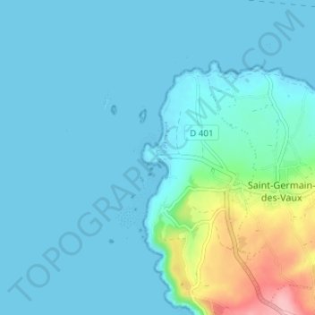
Name: Goury topographic map, elevation, terrain.
Average elevation: 59 ft
Minimum elevation: -7 ft
Maximum elevation: 427 ft
Other topographic maps
Click on a map to view its topography, its elevation and its terrain.
Pointe du Houpret
France > Normandie > Manche > La Hague > Auderville > Laye
Pointe du Houpret, Laye, Auderville, La Hague, Cherbourg, Manche, Normandie, France métropolitaine, 50440, France
Average elevation: 115 ft