
Barra Juan Ángel topographic map
Interactive map
Click on the map to display elevation.
About this map
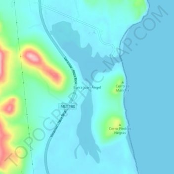
Name: Barra Juan Ángel topographic map, elevation, terrain.
Location: Barra Juan Ángel, Actopan, Veracruz, México (19.56287 -96.40718 19.60287 -96.36718)
Average elevation: 92 ft
Minimum elevation: 0 ft
Maximum elevation: 633 ft
Other topographic maps
Click on a map to view its topography, its elevation and its terrain.
Cerro La Mancha
Cerro La Mancha, Actopan, Veracruz, México
Average elevation: 33 ft