Forest-in-Teesdale topographic map
Interactive map
Click on the map to display elevation.
About this map
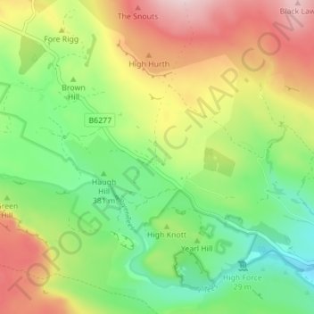
Name: Forest-in-Teesdale topographic map, elevation, terrain.
Average elevation: 1,371 ft
Minimum elevation: 948 ft
Maximum elevation: 1,959 ft

Click on the map to display elevation.
Name: Forest-in-Teesdale topographic map, elevation, terrain.
Average elevation: 1,371 ft
Minimum elevation: 948 ft
Maximum elevation: 1,959 ft