
Municipio San Pedro de Quemes topographic map
Interactive map
Click on the map to display elevation.
About this map
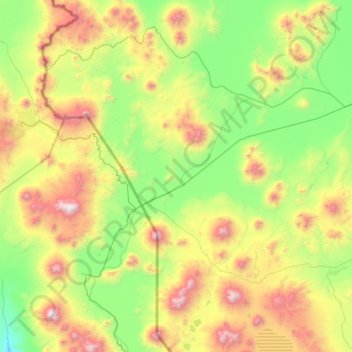
Name: Municipio San Pedro de Quemes topographic map, elevation, terrain.
Average elevation: 13,465 ft
Minimum elevation: 10,932 ft
Maximum elevation: 20,098 ft
Other topographic maps
Click on a map to view its topography, its elevation and its terrain.
Municipio Colcha K
Bolivia > Potosí > Provincia Nor Lípez
Municipio Colcha K, Provincia Nor Lípez, Potosí, Bolivia
Average elevation: 13,077 ft