Geolocate

Lamu topographic map

Click on the map to display elevation.

About this map
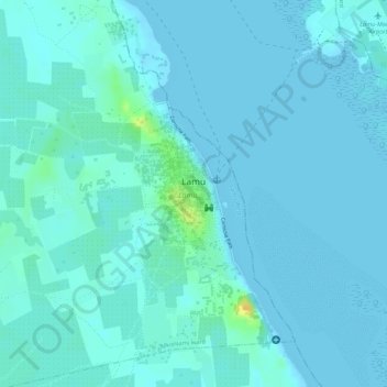
Name: Lamu topographic map, elevation, terrain.

Location: Lamu, Lamu West, Lamu, Kenya (-2.27397 40.89678 -2.26186 40.90428)

Average elevation: 13 ft

Minimum elevation: 0 ft

Maximum elevation: 92 ft

Other topographic maps

Click on a map to view its topography, its elevation and its terrain.

Majengo

Kenya > Lamu > Lamu West > Hindi ward

Average elevation: 62 ft

Bora Imani

Kenya > Lamu > Lamu West > Hindi ward

Average elevation: 23 ft

Jipe

Kenya > Lamu > Lamu West > Hindi ward

Average elevation: 33 ft

Shela

Kenya > Lamu > Lamu West > Shella ward

Average elevation: 16 ft

Mkunumbi

Kenya > Lamu > Lamu West > Mkunumbi ward

Average elevation: 16 ft

Gear up for your next adventure:

🔦Compact Flashlight - Reliable flashlight for emergencies
🏔️Mountain Trail Maps - High‑detail maps for popular peaks
🗃️Trail First Aid Kit - Essential kit for outdoor injuries and emergencies
📦Dry Bags Set - Waterproof storage for electronics and clothes
🧭Compass with Lanyard - Easy‑carry compass for navigation

As an Amazon Associate, this site earns from qualifying purchases at no extra cost to you.