
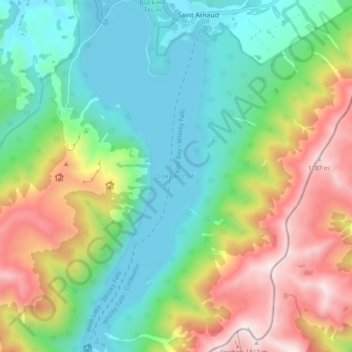
Lake Rotoiti topographic map
Interactive map
Click on the map to display elevation.
About this map
Name: Lake Rotoiti topographic map, elevation, terrain.
Location: Lake Rotoiti, Saint Arnaud, Tasman, New Zealand (-41.87136 172.81524 -41.79837 172.84967)
Average elevation: 3,383 ft
Minimum elevation: 2,014 ft
Maximum elevation: 5,922 ft
Other topographic maps
Click on a map to view its topography, its elevation and its terrain.
Lake Rotoiti
New Zealand > Tasman > Saint Arnaud
Lake Rotoiti, Lakehead Track, Saint Arnaud, Tasman, 7072, New Zealand
Average elevation: 3,383 ft