
绽沟村 topographic map
Interactive map
Click on the map to display elevation.
About this map
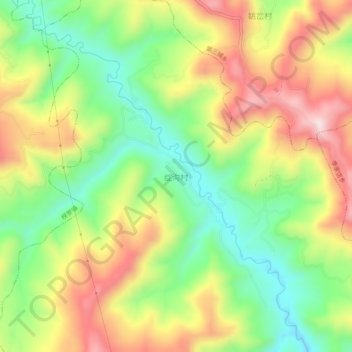
Name: 绽沟村 topographic map, elevation, terrain.
Location: 绽沟村, 常河, 通渭县, 定西市, 甘肃省, 中国 (35.07647 105.02758 35.11647 105.06758)
Average elevation: 6,053 ft
Minimum elevation: 5,446 ft
Maximum elevation: 6,785 ft