
滴水岩村 topographic map
Interactive map
Click on the map to display elevation.
About this map
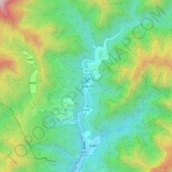
Name: 滴水岩村 topographic map, elevation, terrain.
Location: 滴水岩村, 北峪村, 房山区, 北京市, 中国 (39.85863 115.86098 39.89863 115.90098)
Average elevation: 1,654 ft
Minimum elevation: 673 ft
Maximum elevation: 3,622 ft