Geolocate

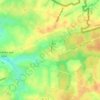
Wormhout topographic map

Click on the map to display elevation.

About this map

Name: Wormhout topographic map, elevation, terrain.

Location: Wormhout, Dunkirk, Nord, Hauts-de-France, Metropolitan France, 59470, France (50.83243 2.44206 50.91739 2.52043)

Average elevation: 59 ft

Minimum elevation: 13 ft

Maximum elevation: 141 ft

Other topographic maps

Click on a map to view its topography, its elevation and its terrain.

La Salmagne

France > Hauts-de-France > Nord > Vieux-Reng

Average elevation: 443 ft

Gauquier

France > Hauts-de-France > Nord > Wattrelos

Average elevation: 89 ft

Malplaquet

France > Hauts-de-France > Nord > Taisnières-sur-Hon

Average elevation: 486 ft

Citadelle de Lille

France > Hauts-de-France > Nord > Lille

Average elevation: 82 ft

Parc Henri Matisse

France > Hauts-de-France > Nord > Lille

Average elevation: 102 ft

Le Corbeau

France > Hauts-de-France > Nord > Verlinghem

Average elevation: 79 ft

Domaine de la Vigne

France > Hauts-de-France > Nord > Bondues

Average elevation: 89 ft

La Goëlle

France > Hauts-de-France > Nord > Prisches

Average elevation: 591 ft

Ovillers

France > Hauts-de-France > Nord > Solesmes

Average elevation: 427 ft

La Distillerie

France > Hauts-de-France > Nord > Ghyvelde

Average elevation: -7 ft

Château de Nieppe

France > Hauts-de-France > Nord > Nieppe

Average elevation: 59 ft

Gear up for your next adventure:

🛰️Handheld GPS Units - Professional satellite navigators for precise backcountry mapping
⌚GPS Sports Watch - GPS watch for running, hiking and training
🔊Portable Camp Speaker - Music and alerts at camp
🥾Hiking Shoes - Durable and comfortable shoes for trail hiking
🧭Pro Hiking Compasses - High-accuracy liquid-filled compasses for topographic orientation

As an Amazon Associate, this site earns from qualifying purchases at no extra cost to you.