
Malingon Creek topographic map
Interactive map
Click on the map to display elevation.
About this map
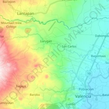
Name: Malingon Creek topographic map, elevation, terrain.
Average elevation: 1,686 ft
Minimum elevation: 955 ft
Maximum elevation: 3,346 ft
Other topographic maps
Click on a map to view its topography, its elevation and its terrain.
Manupali River
Philippines > Bukidnon > Valencia
Manupali River, Valencia, Bukidnon, Northern Mindanao, Philippines
Average elevation: 2,703 ft
Valencia
Philippines > Bukidnon > Valencia
Valencia, Bukidnon, Northern Mindanao, 8708, Philippines
Average elevation: 1,857 ft