
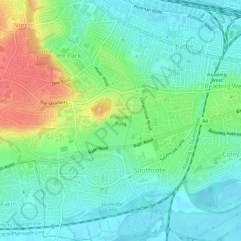
Prospect Park topographic map
Interactive map
Click on the map to display elevation.
About this map
Name: Prospect Park topographic map, elevation, terrain.
Average elevation: 184 ft
Minimum elevation: 121 ft
Maximum elevation: 308 ft
Other topographic maps
Click on a map to view its topography, its elevation and its terrain.
Forest of Arden
United Kingdom > England > Reading
Forest of Arden, Whitley, Reading, England, United Kingdom
Average elevation: 210 ft
View Island
United Kingdom > England > Reading
View Island, Reading Hydro, Caversham, Reading, England, United Kingdom
Average elevation: 148 ft
Whiteknights Lake
United Kingdom > England > Reading
Whiteknights Lake, Whiteknights Road, Newtown, Reading, South East, England, RG6 7BY, United Kingdom
Average elevation: 200 ft