
Cugnod topographic map
Interactive map
Click on the map to display elevation.
About this map
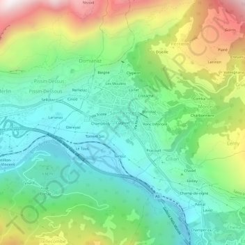
Name: Cugnod topographic map, elevation, terrain.
Location: Cugnod, Cillian, Saint-Vincent, Valle d'Aosta, 11027, Italia (45.72875 7.62744 45.76875 7.66744)
Average elevation: 2,546 ft
Minimum elevation: 1,332 ft
Maximum elevation: 5,003 ft