
Make a donation
Gear up for your next adventure:
As an Amazon Associate, this site earns from qualifying purchases at no extra cost to you.
Coral Gardens topographic map
Click on the map to display elevation.
Make a donation
Gear up for your next adventure:
As an Amazon Associate, this site earns from qualifying purchases at no extra cost to you.
About this map
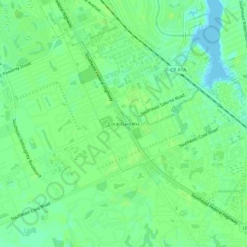
Name: Coral Gardens topographic map, elevation, terrain.
Location: Coral Gardens, Martin County, Florida, 34997, United States (27.11977 -80.23116 27.15977 -80.19116)
Average elevation: 23 ft
Minimum elevation: -7 ft
Maximum elevation: 33 ft
Martin County trails, hiking, mountain biking, running and outdoor activities
Make a donation
Gear up for your next adventure:
As an Amazon Associate, this site earns from qualifying purchases at no extra cost to you.
Other topographic maps
Click on a map to view its topography, its elevation and its terrain.
Jensen Beach
United States > Florida > Martin County > Stuart
The Skyline Drive area includes some of the highest points in the community, reaching an elevation of 70 feet (21 m) at one point.
Average elevation: 16 ft
Make a donation
Gear up for your next adventure:
As an Amazon Associate, this site earns from qualifying purchases at no extra cost to you.
Jonathan Dickinson State Park
United States > Florida > Martin County > Hell Gate
Average elevation: 16 ft