Geolocate

Aglipay topographic map

Click on the map to display elevation.

About this map

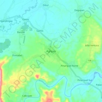
Name: Aglipay topographic map, elevation, terrain.

Location: Aglipay, Quirino, Cagayan Valley, Philippines (16.45077 121.54582 16.53077 121.62582)

Average elevation: 463 ft

Minimum elevation: 292 ft

Maximum elevation: 1,102 ft

Gear up for your next adventure:

🥾Men's Hiking Boots - Durable, waterproof footwear for rugged terrain and steep inclines
🌎3D Topographic Globes - Raised relief globes for a tactile understanding of geography
🪶Paracord Bracelet - Survival bracelet with built‑in tools
🔋Solar Power Banks - Keep your GPS and phone charged in remote wilderness areas
🪶Compact Camp Shovel - Folding shovel for campsite tasks

As an Amazon Associate, this site earns from qualifying purchases at no extra cost to you.