Geolocate

Korbach topographic map

Click on the map to display elevation.

About this map
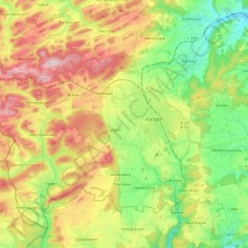
Name: Korbach topographic map, elevation, terrain.

Location: Korbach, Landkreis Waldeck-Frankenberg, Hesse, 34497, Germany (51.20878 8.72745 51.33395 8.96667)

Average elevation: 1,348 ft

Minimum elevation: 810 ft

Maximum elevation: 2,060 ft

Other topographic maps

Click on a map to view its topography, its elevation and its terrain.
Hagenstein

Germany > Hesse > Landkreis Waldeck-Frankenberg

Average elevation: 1,138 ft

Gear up for your next adventure:

🦺Reflective Outdoor Gear - Safety gear for low‑light conditions
📖Nature Tracking Books - Learn to track wildlife and terrain
🖼️Topo Map Wall Art - Decorative topographic prints of famous peaks and regions
🌄Hiking Binoculars - Compact binoculars for scenic views and trail spotting
🌧️Backpack Rain Cover - Keep gear dry in wet weather

As an Amazon Associate, this site earns from qualifying purchases at no extra cost to you.