
Thompsonville topographic map
Click on the map to display elevation.
About this map
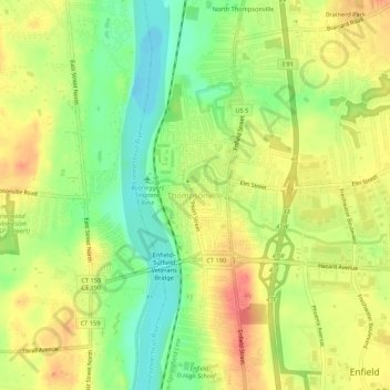
Name: Thompsonville topographic map, elevation, terrain.
Average elevation: 105 ft
Minimum elevation: 3 ft
Maximum elevation: 194 ft
Capitol Planning Region trails, hiking, mountain biking, running and outdoor activities
Other topographic maps
Click on a map to view its topography, its elevation and its terrain.
Southwood Acres
United States > Connecticut > Capitol Planning Region > Enfield
Average elevation: 115 ft
Sherwood Manor
United States > Connecticut > Capitol Planning Region > Enfield > Thompsonville
Average elevation: 148 ft