
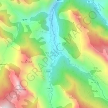
Pola de Somiedo / La Pola topographic map
Interactive map
Click on the map to display elevation.
About this map
Name: Pola de Somiedo / La Pola topographic map, elevation, terrain.
Location: Pola de Somiedo / La Pola, Asturië, 33840, Spanje (43.07315 -6.27725 43.11315 -6.23725)
Average elevation: 3,494 ft
Minimum elevation: 2,090 ft
Maximum elevation: 5,463 ft