
Ulang topographic map
Interactive map
Click on the map to display elevation.
About this map
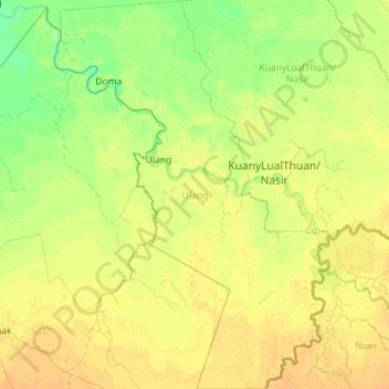
Name: Ulang topographic map, elevation, terrain.
Location: Ulang, Upper Nile, South Sudan (7.98787 32.41169 9.11584 33.21913)
Average elevation: 1,316 ft
Minimum elevation: 1,289 ft
Maximum elevation: 1,352 ft
Other topographic maps
Click on a map to view its topography, its elevation and its terrain.
Malakal
South Sudan > Upper Nile > Malakal
Malakal, Makal Shilluk Island, Malakal, Upper Nile, South Sudan
Average elevation: 1,289 ft
Shol
South Sudan > Upper Nile > Panyikang
Shol, Panyikang, Upper Nile, South Sudan
Average elevation: 1,299 ft
El Seriha
South Sudan > Upper Nile > El Seriha
El Seriha, Upper Nile, South Sudan
Average elevation: 1,434 ft