Geolocate

Hindman topographic map

Click on the map to display elevation.

About this map

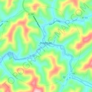
Name: Hindman topographic map, elevation, terrain.

Location: Hindman, Knott County, Kentucky, United States (37.31974 -83.00726 37.34970 -82.96391)

Average elevation: 1,273 ft

Minimum elevation: 1,007 ft

Maximum elevation: 1,742 ft

Knott County trails, hiking, mountain biking, running and outdoor activities

Other topographic maps

Click on a map to view its topography, its elevation and its terrain.

Leburn

United States > Kentucky > Knott County

Average elevation: 1,358 ft

Pine Top

United States > Kentucky > Knott County

Average elevation: 1,398 ft

Amburgey

United States > Kentucky > Knott County

Average elevation: 1,453 ft

Dry Creek

United States > Kentucky > Knott County

Average elevation: 1,394 ft

Gear up for your next adventure:

🧭Outdoor Navigation Book - Learn advanced navigation skills
📷Action Cameras - Rugged cameras to document your journeys across rugged terrain
GPS Sports Watch - GPS watch for running, hiking and training
🧷Carabiner Set - Durable clips for gear attachment
🌡️Portable Weather Meter - Track weather conditions on the trail

As an Amazon Associate, this site earns from qualifying purchases at no extra cost to you.