
Dormaal topographic map
Interactive map
Click on the map to display elevation.
About this map
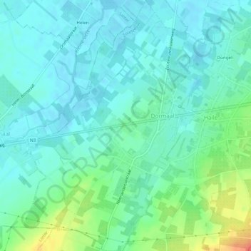
Name: Dormaal topographic map, elevation, terrain.
Location: Dormaal, Léau, Louvain, Brabant flamand, Flandre, Belgique (50.79104 5.07240 50.82167 5.10961)
Average elevation: 141 ft
Minimum elevation: 102 ft
Maximum elevation: 266 ft
Other topographic maps
Click on a map to view its topography, its elevation and its terrain.
Halle-Booienhoven
Halle-Booienhoven, Léau, Brabant flamand, Flandre, 3440, Belgique
Average elevation: 151 ft
Halle-Booienhoven
Halle-Booienhoven, Léau, Louvain, Brabant flamand, Flandre, Belgique
Average elevation: 154 ft