Geolocate

Sulphur topographic map

Click on the map to display elevation.

About this map

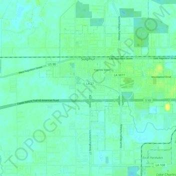
Name: Sulphur topographic map, elevation, terrain.

Location: Sulphur, Calcasieu Parish, Louisiana, 70663, United States (30.19091 -93.40551 30.25293 -93.30435)

Average elevation: 20 ft

Minimum elevation: -7 ft

Maximum elevation: 62 ft

Calcasieu Parish trails, hiking, mountain biking, running and outdoor activities

Other topographic maps

Click on a map to view its topography, its elevation and its terrain.

Hayes

United States > Louisiana > Calcasieu Parish

Average elevation: 13 ft

Starks

United States > Louisiana > Calcasieu Parish

Average elevation: 26 ft

Berry Bay

United States > Louisiana > Calcasieu Parish

Average elevation: 13 ft

Sulphur

United States > Louisiana > Calcasieu Parish > Sulphur > Sulphur

Average elevation: 20 ft

Gear up for your next adventure:

🥩Freeze-Dried Meals - Nutritious and lightweight food for remote expeditions
🪶LED Camping Lantern - Bright lantern for camp lighting
🧺Microfiber Travel Towels - Compact and fast-drying towels for trail use
🔥Camping Stove - Portable stove for camping and backcountry cooking
Backpacking Tents - Weight-optimized shelters for multi-day topographic surveys

As an Amazon Associate, this site earns from qualifying purchases at no extra cost to you.