
Lago di Sils topographic map
Interactive map
Click on the map to display elevation.
About this map
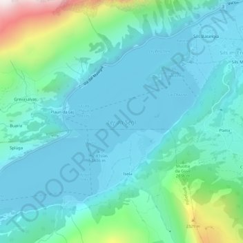
Name: Lago di Sils topographic map, elevation, terrain.
Average elevation: 6,391 ft
Minimum elevation: 5,873 ft
Maximum elevation: 8,743 ft
Other topographic maps
Click on a map to view its topography, its elevation and its terrain.
Piz Corvatsch
Svizzera > Grigioni > Sils im Engadin/Segl
Piz Corvatsch, Sils im Engadin/Segl, Maloja, Grigioni, Svizzera
Average elevation: 9,616 ft