
Thank you for supporting this site ❤️
Make a donation
Make a donation
Gear up for your next adventure:
As an Amazon Associate, this site earns from qualifying purchases at no extra cost to you.
Moledo topographic map
Click on the map to display elevation.
Thank you for supporting this site ❤️
Make a donation
Make a donation
Gear up for your next adventure:
As an Amazon Associate, this site earns from qualifying purchases at no extra cost to you.
About this map
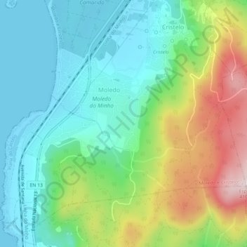
Name: Moledo topographic map, elevation, terrain.
Location: Moledo, Moledo e Cristelo, Caminha, Viana do Castelo, Portugal (41.82827 -8.87686 41.85756 -8.83219)
Average elevation: 413 ft
Minimum elevation: 0 ft
Maximum elevation: 1,322 ft
Thank you for supporting this site ❤️
Make a donation
Make a donation
Gear up for your next adventure:
As an Amazon Associate, this site earns from qualifying purchases at no extra cost to you.