
Corral de Piedra topographic map
Interactive map
Click on the map to display elevation.
About this map
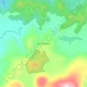
Name: Corral de Piedra topographic map, elevation, terrain.
Location: Corral de Piedra, Amanalco, Estado de México, México (19.19078 -99.98891 19.23078 -99.94891)
Average elevation: 9,596 ft
Minimum elevation: 8,917 ft
Maximum elevation: 10,883 ft
Other topographic maps
Click on a map to view its topography, its elevation and its terrain.
San Bartolo
México > Estado de México > Amanalco > Polvillos (San Bartolo 5ta Secc)
San Bartolo, Polvillos (San Bartolo 5ta Secc), Amanalco, Estado de México, 51207, México
Average elevation: 7,382 ft