
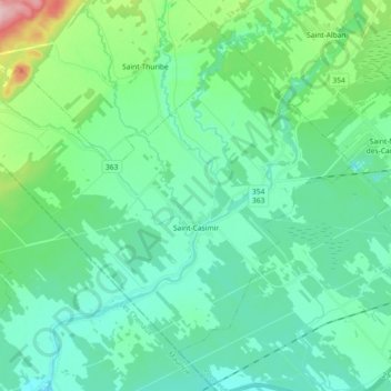
Saint-Casimir topographic map
Interactive map
Click on the map to display elevation.
About this map
Name: Saint-Casimir topographic map, elevation, terrain.
Average elevation: 161 ft
Minimum elevation: 26 ft
Maximum elevation: 719 ft
Other topographic maps
Click on a map to view its topography, its elevation and its terrain.
Saint-Gilbert
Canada > Quebec > Portneuf (MRC)
Saint-Gilbert, Portneuf (MRC), Capitale-Nationale, Quebec, Canada
Average elevation: 282 ft
Pont-Rouge
Canada > Quebec > Portneuf (MRC)
Pont-Rouge, Portneuf (MRC), Capitale-Nationale, Quebec, Canada
Average elevation: 384 ft