
Hasanabad RD topographic map
Interactive map
Click on the map to display elevation.
About this map
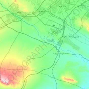
Name: Hasanabad RD topographic map, elevation, terrain.
Location: Hasanabad RD, Fashapuyeh District, Rey County, Iran (35.16683 50.84317 35.49280 51.34011)
Average elevation: 3,530 ft
Minimum elevation: 2,871 ft
Maximum elevation: 6,302 ft
Other topographic maps
Click on a map to view its topography, its elevation and its terrain.
Dotuye sofla
Iran > Rey County > Kahrizak RD
Dotuye sofla, Kahrizak RD, Kahrizak District, Rey County, Tehran Province, Iran
Average elevation: 3,156 ft
دهستان خاوران شرقی
دهستان خاوران شرقی, Khavaran District, Rey County, Tehran Province, Iran
Average elevation: 4,249 ft
Baqershahr
Baqershahr, Kahrizak District, Rey County, Iran
Average elevation: 3,360 ft
Rey
Rey, Rey Central District, Rey County, Tehran Province, Iran
Average elevation: 3,514 ft