
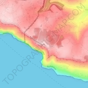
Ta’ Dmejrek topographic map
Interactive map
Click on the map to display elevation.
About this map
Name: Ta’ Dmejrek topographic map, elevation, terrain.
Location: Ta’ Dmejrek, Siġġiewi, Southern Region, DGL 1942, Malta (35.84565 14.39696 35.84575 14.39706)
Average elevation: 427 ft
Minimum elevation: 0 ft
Maximum elevation: 827 ft
Ta' Dmejrek is the highest point of Malta, located on the Dingli Cliffs, with an elevation of 253 metres (830 ft) above sea level.