
Garh topographic map
Interactive map
Click on the map to display elevation.
About this map
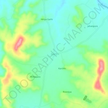
Name: Garh topographic map, elevation, terrain.
Location: Garh, Choti Sarvan Tehsil, Banswara District, Rajasthan, India (23.53311 74.69862 23.57311 74.73862)
Average elevation: 1,286 ft
Minimum elevation: 1,148 ft
Maximum elevation: 1,585 ft
Other topographic maps
Click on a map to view its topography, its elevation and its terrain.
Tejpur
India > Rajasthan > Choti Sarvan Tehsil
Tejpur, Choti Sarvan Tehsil, Banswara District, Rajasthan, India
Average elevation: 1,063 ft