
Eden topographic map
Click on the map to display elevation.
Eden
Eden is a census-designated place in Weber County, Utah, United States. It is home to Powder Mountain ski resort. It lies between the North and Middle Fork of the Ogden River, north of Pineview Reservoir, in the Ogden Valley. The elevation is 4,941 feet (1,506 m). The population was 600 at the 2010 census. It has a post office with the ZIP code 84310. Eden is part of the Ogden–Clearfield, Utah Metropolitan Statistical Area, as well as the Ogden Valley census county division
About this map
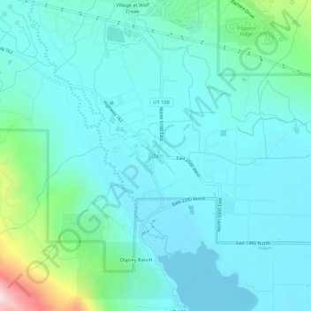
Name: Eden topographic map, elevation, terrain.
Average elevation: 5,125 ft
Minimum elevation: 4,869 ft
Maximum elevation: 6,444 ft
Weber County trails, hiking, mountain biking, running and outdoor activities
Other topographic maps
Click on a map to view its topography, its elevation and its terrain.