Geolocate

Conway topographic map

Click on the map to display elevation.

About this map

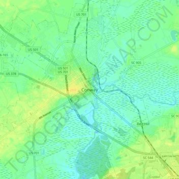
Name: Conway topographic map, elevation, terrain.

Location: Conway, Horry County, South Carolina, 29528, United States (33.79600 -79.08781 33.87600 -79.00781)

Average elevation: 26 ft

Minimum elevation: -3 ft

Maximum elevation: 59 ft

Horry County trails, hiking, mountain biking, running and outdoor activities

Gear up for your next adventure:

📶Vehicle Signal Boosters - Improve reception in rural areas while driving to trailheads
📷Action Cameras - Rugged cameras to document your journeys across rugged terrain
🛌Ultralight Sleeping Bags - Compact down bags for cold nights in the wilderness
🌧️Backpack Rain Cover - Keep gear dry in wet weather
🛶Inflatable Kayak - Portable kayak for rivers, lakes, and expeditions

As an Amazon Associate, this site earns from qualifying purchases at no extra cost to you.