
Twenty-Nine Palms Band topographic map
Interactive map
Click on the map to display elevation.
About this map
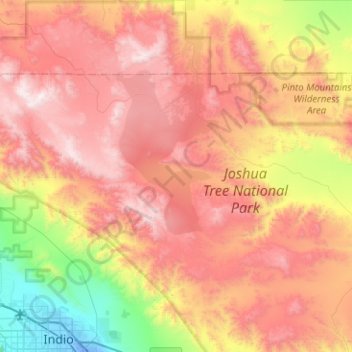
Name: Twenty-Nine Palms Band topographic map, elevation, terrain.
Average elevation: 2,949 ft
Minimum elevation: -59 ft
Maximum elevation: 5,807 ft
Other topographic maps
Click on a map to view its topography, its elevation and its terrain.
Twentynine Palms
United States > California > San Bernardino County > Twentynine Palms
Twentynine Palms, San Bernardino County, California, 92278, United States
Average elevation: 2,264 ft