
Łańcut County topographic map
Interactive map
Click on the map to display elevation.
About this map
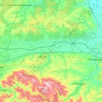
Name: Łańcut County topographic map, elevation, terrain.
Location: Łańcut County, Subcarpathian Voivodeship, Poland (49.92641 22.08572 50.24682 22.45211)
Average elevation: 755 ft
Minimum elevation: 548 ft
Maximum elevation: 1,365 ft