
Ardmore topographic map
Click on the map to display elevation.
About this map
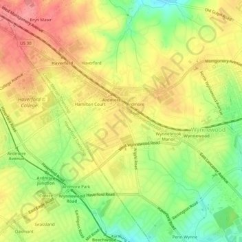
Name: Ardmore topographic map, elevation, terrain.
Average elevation: 325 ft
Minimum elevation: 171 ft
Maximum elevation: 446 ft
Montgomery County trails, hiking, mountain biking, running and outdoor activities
Other topographic maps
Click on a map to view its topography, its elevation and its terrain.
Penn Valley
United States > Pennsylvania > Montgomery County > Lower Merion Township > Ardmore
Average elevation: 292 ft
Haverford
United States > Pennsylvania > Montgomery County > Lower Merion Township > Ardmore
Average elevation: 338 ft
Hamilton Court
United States > Pennsylvania > Montgomery County > Lower Merion Township > Ardmore
Average elevation: 335 ft
Haverford
United States > Pennsylvania > Montgomery County > Lower Merion Township > Ardmore
Average elevation: 338 ft