Geolocate

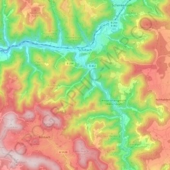
Schiltach topographic map

Click on the map to display elevation.

Schiltach

Schiltach lies on the eastern side of the Black Forest, at the confluence of the Schiltach and Kinzig rivers. It lies at an altitude of 330 metres (1,083 ft).

Wikipedia (CC-BY-SA 3.0)

About this map

Name: Schiltach topographic map, elevation, terrain.

Location: Schiltach, Verwaltungsgemeinschaft Schiltach, Landkreis Rottweil, Baden-Württemberg, 77761, Germany (48.24310 8.27668 48.30560 8.39215)

Average elevation: 1,929 ft

Minimum elevation: 984 ft

Maximum elevation: 2,877 ft

Gear up for your next adventure:

🧺Microfiber Travel Towels - Compact and fast-drying towels for trail use
🔥Camping Stove - Portable stove for camping and backcountry cooking
🧣Merino Neck Gaiters - Multi-functional headwear for wind and sun protection
🧭GPS Watch Accessories - Bands and chargers for GPS watches
🩹Survival Bandages - High‑quality bandages for emergencies

As an Amazon Associate, this site earns from qualifying purchases at no extra cost to you.