
浯田坑 topographic map
Interactive map
Click on the map to display elevation.
About this map
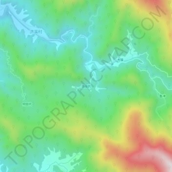
Name: 浯田坑 topographic map, elevation, terrain.
Location: 浯田坑, 济溪村, 江湾镇, 婺源县, 上饶市, 江西省, 中国 (29.33679 118.12263 29.37679 118.16263)
Average elevation: 1,207 ft
Minimum elevation: 512 ft
Maximum elevation: 2,707 ft