
Rothemann topographic map
Interactive map
Click on the map to display elevation.
About this map
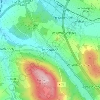
Name: Rothemann topographic map, elevation, terrain.
Location: Rothemann, Eichenzell, Landkreis Fulda, Hessen, 36124, Duitsland (50.44729 9.68331 50.48729 9.72331)
Average elevation: 1,109 ft
Minimum elevation: 889 ft
Maximum elevation: 1,611 ft