
Silverwater topographic map
Interactive map
Click on the map to display elevation.
About this map
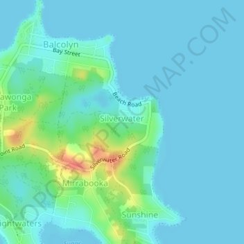
Name: Silverwater topographic map, elevation, terrain.
Average elevation: 30 ft
Minimum elevation: 0 ft
Maximum elevation: 161 ft
Other topographic maps
Click on a map to view its topography, its elevation and its terrain.
Lake Macquarie
Australia > New South Wales > Silverwater
Lake Macquarie, Silverwater, Lake Macquarie City Council, New South Wales, 2264, Australia
Average elevation: 66 ft